In brief
- Users demand access to services along their journey through location-based services. Automakers and vendors have to acknowledge these demands
- Zoreza Global provides enhanced and seamless navigation user experiences across all devices — serving any location-based user needs
- Digital maps are now perceived as a holistic reflection of the real world
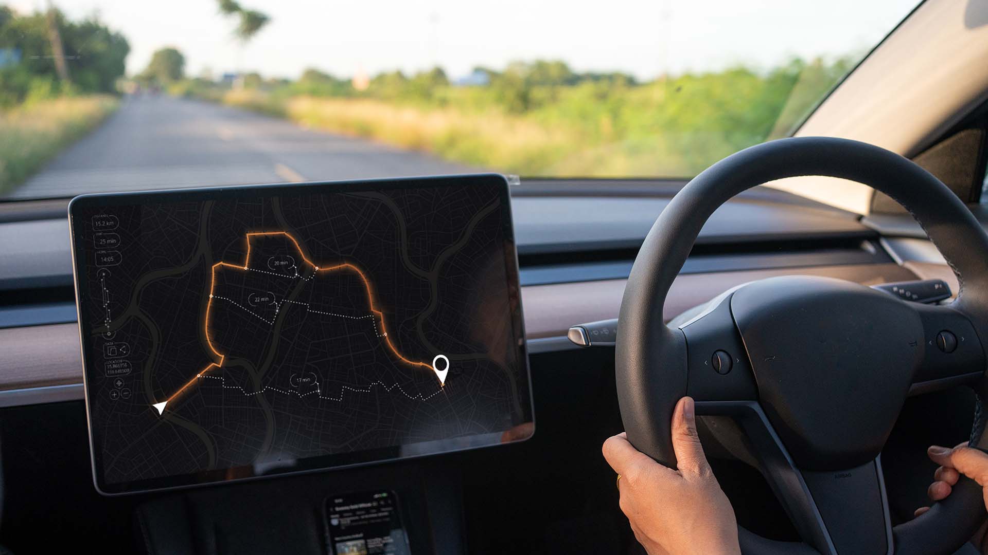
With digital services becoming increasingly common, our perception of the world and our environment is changing. The way we see the world is literally and figuratively effected by growing digital capabilities. Consequently, our expectations for traveling and tourism are evolving too. We now hold safety and experience at the top of our wish list — a paper map and a car without an online connection just won’t cut it anymore. Thankfully, location-based services have the solution.
Zoreza Global is a trusted automotive partner with extensive knowledge and capabilities in location-based services, ready to accelerate your software-defined transformation. We support with developing full-stack location-based services, starting from geospatial data collection, annotation and processing, up to a variety of services and applications, including electronic horizon, map-provisioning, in-dash and mobile navigations. Focusing on serving end users with multi-modal navigation experiences and an easy way of finding parking spaces, making electric vehicle (EV) journeys enjoyable, even before they start. Benefit from location-based services in-door and on the roads.

Maps and books: Planning, the old-fashioned way
Have you ever tried to plan a trip using a road atlas? You probably asked yourself things like — What sequence of roads would be best? At which junction do I need to change roads? Which road numbers matter? etc. Then there’s the extra information like — What is the exact distance I will travel during my trip? What are the current road conditions? When will I arrive at my destination? Are there any tolls or planned roadworks on my route?
Ultimately, you’re left with a complicated, distracting set of instructions and queries that took a long time to create.

Planning in the digital age: Instant answers
With digital maps and real-time traffic information, you can find the best route in seconds, along with a reliable estimated time of arrival (ETA). What’s more, you get alternative routes, plus the traffic situation on each of them. Take this flexibility and speed one step further and you can find out a lot more about the possible user experiences along the journey. For example, you could ask:
- Where can I park my car? Can I get guidance for reaching the exact parking place inside the garage if it’s multi-layered or large?
- Where can I stop and walk my dog or give my kids a break on a long journey?
- What kind of transportation can I use for the last mile after parking my car?
- Is there anything interesting in the area that I'm driving through? Are there any events or festivals going on in the area right now?
- What are the driving restrictions, tolls or ecological zones? Is there anything else that I should know while driving through the area?
- When do I need to recharge my car? How long will it take? Can I reserve a charging place? Where is the exact location of the charger I reserved?
- What can I do while my car is charging? Can I have lunch? Is there any entertainment near the charging station? How do I find the exact location of a restaurant inside a certain building?
The list of questions is endless. But the most exciting thing is — all these questions can be answered right now.
Next step: Up-to-the-minute online information
With the digitized maps available, being online while traveling is the only thing needed to answer those questions. Nowadays, it’s almost normal that personal mobile devices — like smartphones or tablets — are connected to the internet. And the percentage of connected devices is ever growing so the answers come easily and instantly.
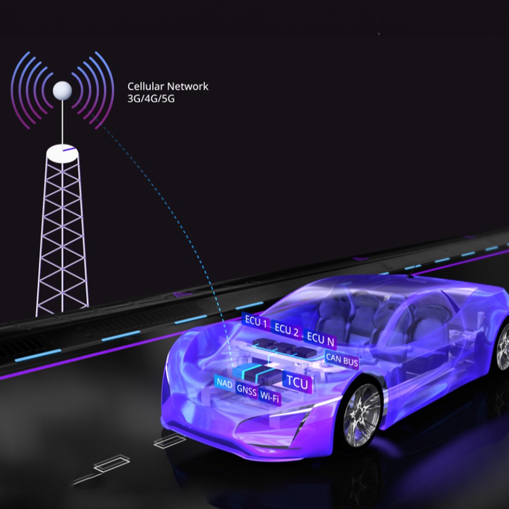
Connectivity in cars is growing too; the number of vehicles connected to the internet is surging. This is great, as being online makes it possible to always receive updated and reliable data. Moreover, if this data is created through the analysis of data streams coming from the huge number of road users online and on the move, it opens up the possibilities of shared mobility.
At the same time though, this creates another technical challenge — enormous amounts of data have to be processed on the fly. Leading geospatial data processing companies — like HERE, Microsoft, Amazon and Google — have accepted this technical challenge. They offer their platforms for custom data processing and creation of location-based services for industry-needed solutions. With the support of these platforms, shared mobility becomes a reality: Indoor navigation, on- and off-street parking, multi-modal routing, and other advanced location-based usage scenarios — all this, and more, is now possible.
Being safe on the road
In addition to user experience, location-based services also have an important impact on road safety. Having the ability to collect data from cars (as cars become digital sensors) and process it in cloud platforms enables the creation of detailed digital maps. These maps, enriched with the latest data and in high definition, are continuously updated so that they always represent current real-world conditions. This could be a huge step forward for road safety. Imagine being warned about bad weather conditions on your route (e.g., heavy rain, fog, storms), dangerous road conditions in your area (e.g., black ice, lane closures) or traffic disturbances on the upcoming stretch of your journey (e.g., traffic jams or unforeseen road blockages). Being warned in advance will raise your alertness and can prevent accidents.
A highly detailed map is also one of the key aspects of enabling advanced driver assistance systems (ADAS) and autonomous driving (AD). The map is needed when predicting the most probable path the car will take and when calculating road clearance — a key feature for safe autonomous driving.
Why Zoreza Global
You’ll find more than one reason to trust us as your guide in the world of location-based services:
- We have more than 15 years’ experience in the development of a variety of location-based services, especially in map database compilers, core functions (like 3D map rendering), business logic implementation and integration into automotive systems (like QNX, Linux and Android Automotive). Development of navigation-HMIs using Kanzi, Qt, Flutter, JetPack and others, cooperating with key map and navigation platform providers, developing navigation products for elite, premium and volume OEMs from all continents adds to our portfolio
- We’re a global company and therefore can be local to you but with the best talent from all over the world
- We operate in cost-efficient locations, ensuring a global spread of our culture and engineering best practices
Driving forward under a new name
Zoreza Global has been working in the area of geospatial data processing and embedded navigation solutions development since 2007. Together with market trends, our focus has increasingly shifted to the cloud and mobile devices, so our offering goes far beyond the embedded part. For this reason, we’ve changed the name of our offering from Navigation to Location-Based Services (LBS) to underline our wide focus.
To get more information, visit our website or contact us directly.


